
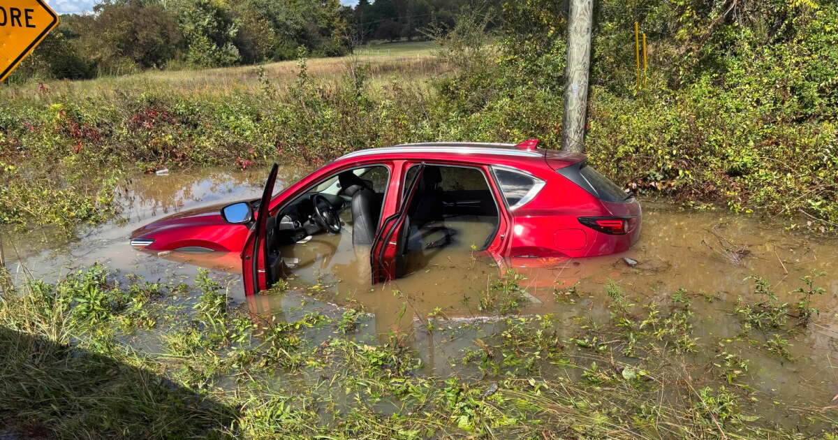
For months, North Carolina has been locked in one of its most severe drought cycles in recent memory — but last weekend, the remnants of Hurricane Isaias brought a dramatic shift for communities in the western part of the state. While the storm caused flooding and destruction, it also delivered something parched counties desperately needed: rain.
After cutting through Florida and Alabama, the storm’s remnants reached North Carolina on Sunday, dumping upward of 9 inches of rainfall in some mountain and foothills areas, while portions of the coastal plain remained relatively dry. The North Carolina State Climate Office reported that groundwater levels in Pisgah Forest in Transylvania County returned to normal for the first time since January — a meaningful milestone after a prolonged dry spell.
The storm wasn’t without its consequences. The National Weather Service confirmed 13 tornadoes struck central North Carolina over the weekend. McDowell County officials responded to flooded roads and five landslides, and two people had to be rescued in Burke County after the Catawba River overflowed its banks.
Where the Drought Stands Now
Despite the welcome rainfall in the foothills, much of North Carolina remains in serious drought. The North Carolina Drought Management Advisory Council recorded 22 counties still classified under severe drought and 8 counties under extreme drought as of October 15. The foothills region has largely escaped drought conditions, but counties in and east of the Triangle continue to face severe or extreme designations. On a more encouraging note, no part of the state is currently experiencing an exceptional drought — the most dangerous classification — for the first time in months.
The U.S. Climate Prediction Center expects drought conditions across the state to resolve within the next three months.
A Look Back: How the Drought Developed
The October 8 weekly update showed that heavy rain had finally lifted Brunswick County out of its extreme drought classification, and streamflow at Trent River was approaching normal levels. But most of North Carolina saw little change. The stubborn dryness had already diminished yields for corn, peanuts, cotton, and other crops across the state. The advisory council also noted that trees were beginning to show their autumn colors earlier than expected, with some species already shedding leaves.
Through late September and into October, the advisory council described conditions as “a drought within a drought,” particularly on the eastern side of the state. Cape Hatteras logged its second-driest September on record. A pocket of exceptional drought lingered in Guilford and Rockingham counties, while several coastal counties saw their classifications worsen. At the same time, some mountain towns like Boone and Hickory received above-average September rainfall, and the W. Kerr Scott Reservoir in Wilkesboro climbed above its target level.
The week of September 17 brought bad news for eastern counties, where multiple areas saw drought conditions escalate from moderate to severe. Streamflows on the Dan River hit daily record lows, and Asheville recorded its driest start to September in 10 years, according to the North Carolina Drought Advisory Council’s report. Wake County fell back into severe drought conditions that week. However, Raleigh Water’s Environmental Coordinator Ed Buchan said it’s unlikely the city will have to restrict water supply again, noting that predictions show a strong chance of recovery this winter. The advisory council also cautioned that the state could see increased wildfire risk in early fall.
By late August, the Drought Management Advisory Council’s report described a “tale of two halves” — the mountains and foothills received up to four inches of rain while the Piedmont and coast remained hot and dry. Wilmington saw its wettest seven-day stretch in two years, with over 8 inches of rain. McDowell County was completely free of drought conditions, though five Piedmont counties remained in extreme drought.
In August, businesses affected by the drought became eligible for federal aid. Beginning in March 2027, the U.S. Small Business Administration will offer low-interest loans to small businesses, private nonprofits, faith-based organizations, and small agricultural entities impacted by the drought.
Through much of the summer, water restriction decisions varied widely across the state. Durham maintained water restrictions even as Raleigh and Fuquay-Varina lifted theirs. Raleigh Water users had consumed more water in April, May, and June of this year than during the same period in 2025, even while Stage One restrictions were already in place.
Governor Josh Stein addressed the situation publicly in late July.
“Although recent rainfall has made a dent in the problem, we’re not in the clear yet,”
he said, urging residents to check their local water system’s conservation status. DEQ Secretary Reid Wilson echoed that message:
“It may seem odd to talk about drought and continued water conservation after days of very wet weather, but we need to make up for months of extremely dry conditions.”
The drought’s origins trace back to a dry fall in 2025 and an equally dry start to 2026. By early June, exceptional drought — the most severe category on the scale — had taken hold across Durham, Orange, and Alamance counties. Stage 2 water restrictions went into effect for Durham, and streamflows on the Neuse River hit record lows. By late June, Wake County had joined 40 other counties in extreme drought, with high evaporation rates from ongoing heat waves making it harder for rainfall to replenish water sources.
In May, the remnants of Tropical Storm Arthur brought about an inch of rain — far too little to make a meaningful dent, according to state drought officials. Lightning strikes and low humidity fueled wildfires across the Piedmont and Coastal Plain. Crops statewide were wilting or stunted from lack of moisture.
Understanding the Drought Scale
Both the North Carolina Drought Management Advisory Council and the U.S. Drought Monitor use the same five-level classification system. At the least severe end, D0 (abnormally dry) signals lawn browning and mild crop stress. D1 (moderate drought) brings reduced streamflow and declining hay production. D2 (severe drought) can prompt the closure of swimming areas and boat ramps. D3 (extreme drought) typically triggers outdoor burn bans. At the most severe level, D4 (exceptional drought) affects daily life for all residents, with officials beginning to calculate how many days of water supply remain.
According to the Department of Environmental Quality, residents should check with their local water supply system for information about current water use restrictions. A full list of drought impacts and county-level classifications is available here.










Comments are closed.